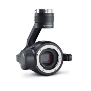
Product Overview
| Product Name | Zenmuse P1 |
| Dimensions | 198 × 166 × 129 mm |
| Weight | Approx. 800 g |
| Power | 20 W |
| IP Rating | IP4X |
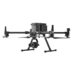
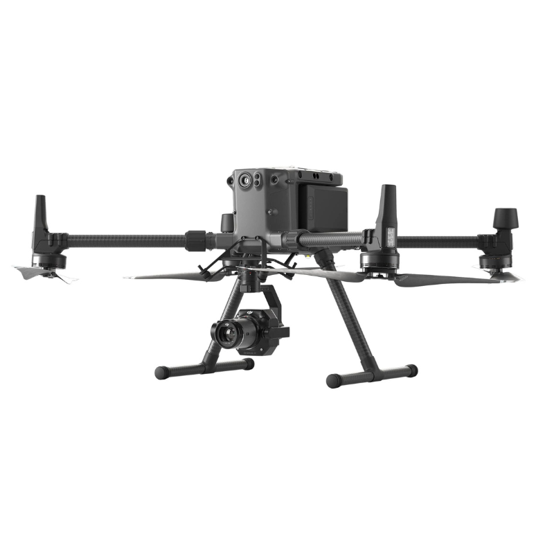
| Supported Aircraft | Matrice 300 RTK, Matrice 350 RTK, Matrice 400 |
| Operating Temperature | -20° to 50° C (-4° to 122° F) |
| Storage Temperature | -20° to 60° C (-4° to 140° F) |
| Absolute Accuracy | Horizontal: 3 cm, Vertical: 5 cm |
| Sensor Type | Full-frame, 35.9 × 24 mm |
| Effective Pixels | 45 MP |
| Pixel Size | 4.4 μm |
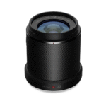
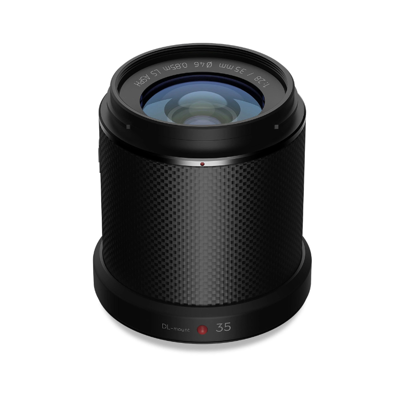
| Supported Lenses | DL 24mm, DL 35mm, DL 50mm |
| Photo Size | 8192 × 5460 (3:2) |
| Minimum Photo Interval | 0.7 s |
| Shutter Speed | Mechanical: 1/2000 – 1 s, Electronic: 1/8000 – 1 s |
| Aperture Range | f/2.8 – f/16 |
| ISO Range | 100 – 25,600 (Photo & Video) |
| Video Resolution | 1080p & 4K (up to 60 fps) |
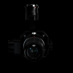
| Gimbal Stabilization | 3-axis, ±0.01° angular vibration range |
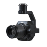
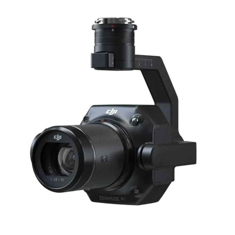
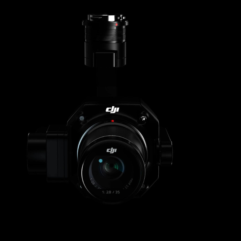
DJI Zenmuse P1 ek professional full-frame aerial survey camera hai jo specially Matrice 300 RTK, Matrice 350 RTK aur Matrice 400 drones ke liye design kiya gaya hai. 45 MP full-frame sensor, interchangeable DL lenses aur high-precision 3-axis gimbal stabilization ke saath, yeh payload photogrammetry aur mapping ke liye industry standard ban chuka hai. Compact design, ±0.01° angular vibration range aur centimeter-level accuracy ke saath, Zenmuse P1 aerial mapping professionals ko unmatched efficiency aur precision provide karta hai.
Zenmuse P1 ka 45 MP full-frame sensor (35.9×24 mm) har flight mein high-resolution aerial imagery deliver karta hai. 4.4 μm pixel size aur wide ISO range (100–25600) ke saath, yeh low light conditions mein bhi sharp aur clear results deta hai.
Payload DJI ke DL 24mm, 35mm aur 50mm ASPH lenses support karta hai, jisme har ek lens hood aur balancing ring ke saath aata hai. Wide 84° FOV se lekar precise 46.8° tele coverage tak, yeh flexibility different mapping aur surveying scenarios ke liye perfect hai.
RTK compatibility aur advanced gimbal stabilization ke saath, Zenmuse P1 horizontal 3 cm aur vertical 5 cm tak ki absolute accuracy achieve karta hai. Ye precision professional photogrammetry projects ke liye reliable results ensure karta hai.
0.7 second ka minimum photo interval aur mechanical shutter (1/2000 s tak) fast image capturing allow karta hai. Isse large-scale mapping projects jaldi complete hote hain without motion blur.
P1 photo, video aur playback operation modes support karta hai. 8K photo resolution (8192×5460) ke saath-saath 4K aur Full HD video recording (up to 60 fps) bhi possible hai, jo aerial documentation ko aur bhi flexible banata hai.
Gimbal system tilt (-130° to +40°), roll (-55° to +55°) aur pan (±320°) range cover karta hai. ±0.01° angular vibration range ke saath, har frame sharp aur perfectly aligned hota hai – jo mapping ke liye essential hai.
Approx. 800 g weight aur IP4X rating ke saath, Zenmuse P1 lightweight hone ke saath durable bhi hai. -20°C to 50°C operating range aur -20°C to 60°C storage range ensure karta hai ki yeh payload harsh environments mein bhi efficiently kaam kare.
P1 ko DJI Matrice 300/350/400 RTK ke SkyPort mount par securely attach karein.
Drone aur payload ko power on karke DJI Pilot app se sensor calibration complete karein.
Mapping mission parameters (altitude, overlap, shutter speed) set karein.
Real-time gimbal stabilization aur live feed monitor karein.
Flight ke baad images aur GNSS raw observation data SD card se download karke processing software mein analyze karein.
Camera lens aur sensor cover ko microfiber cloth se gently wipe karein.
Dust particles remove karne ke liye soft air blower use karein.
Gimbal joints aur connectors ko dry cloth se clean karein.
Lens filters aur hood ko alag karke carefully wash aur dry karein.
Cleaning ke baad payload ko hamesha padded case mein secure karein.
Payload ko shock-proof case mein store karein taaki accidental damage na ho.
Extreme heat, cold ya direct sunlight exposure avoid karein.
Drone ke mount aur connectors ko regular check aur clean karein.
Firmware aur DJI Pilot app ko hamesha updated rakhein.
Flight se pehle aur baad lens aur gimbal system inspect karein.
Zenmuse P1 sirf DJI Matrice 300/350/400 RTK drones ke saath hi use karein.
Flight se pehle ensure karein ki gimbal aur lens properly locked ho.
Har flight se pehle storage card format aur free space check karein.
Wet ya high-humidity conditions mein payload use karne se bachein.
Payload ko transport karte waqt hamesha case mein store karke dismount karein.
DJI Zenmuse P1 ek state-of-the-art aerial photogrammetry solution hai jo speed, accuracy aur efficiency ka perfect combination deliver karta hai. Full-frame sensor, interchangeable lenses aur centimetre-level accuracy ke saath, yeh payload aerial mapping aur surveying ke liye unbeatable choice hai. Agar aapko reliable, high-quality aur fast mapping solution chahiye, toh Zenmuse P1 aapke workflow ko next level par le jayega.
24mm F2.8 (84° FOV), 35mm F2.8 (63.5°), and 50mm F2.8 (46.8°)—these are all LS ASPH lenses with hoods/balancing rings/filters for photogrammetry.
3 cm horizontal accuracy and 5 cm vertical accuracy using RTK; exit pupil compensation and time sync at microseconds of exposure improve accuracy without GCP.
Matrice 300/350 RTK (using only the single port), Matrice 400 (for only single or dual ports; dual payload will degrade accuracy); full RTK with complete obstacle avoidance.
Photo resolutions are 4K JPEG/DNG (8192×5460, 3:2) at 45MP; 4K@60fps for the 35mm lens or you can shoot in 1080p MP4/MOV; interval of very low as 0.7 seconds; mechanical shutter at 1/2000 sec to 1 sec (f≤5.6).
Route or noticed operation with waypoint auto or infinity focus; Manual mode only manual, no zoom; Apertures from f/2.8 to f/16; and ISO from 100 to 25,600 for snowy or very bright day lighting.
It gives +ISO to make it less sensitive to background noise, allowing the drone to work in lower conditions, like a survey at dawn or dusk, without losing quality.
| Specification | Details |
|---|---|
| Product Name | Zenmuse P1 |
| Dimensions | 198 × 166 × 129 mm |
| Weight | Approx. 800 g |
| Power | 20 W |
| IP Rating | IP4X |
| Supported Aircraft | Matrice 300 RTK, Matrice 350 RTK, Matrice 400 |
| Operating Temperature Range | -20° to 50° C (-4° to 122° F) |
| Storage Temperature Range | -20° to 60° C (-4° to 140° F) |
| Absolute Accuracy | Horizontal: 3 cm, Vertical: 5 cm* *Using Mapping Mission at a GSD of 3 cm and flight speed of 15 m/s, with 75% front overlap rate and 55% side overlap rate. |
| Specification | Details |
|---|---|
| Sensor | Sensor size (Still): 35.9×24 mm (Full frame)Sensor size (Max video recording area): 34×19 mmEffective Pixels: 45MPPixel size: 4.4 μm |
| Supported Lenses | DJI DL 24mm F2.8 LS ASPH (with lens hood and balancing ring/filter), FOV 84°DJI DL 35mm F2.8 LS ASPH (with lens hood and balancing ring/filter), FOV 63.5°DJI DL 50mm F2.8 LS ASPH (with lens hood and balancing ring/filter), FOV 46.8° |
| Supported SD Cards | SD: UHS-I rating or above; Max capacity: 512 GB |
| Storage Files | Photo / GNSS Raw Observation Data / Image Log File |
| Photo Size | 3:2 (8192×5460) |
| Operation Modes | Photo, Video, Playback |
| Minimum Photo Interval | 0.7 s |
| Shutter Speed | Mechanical Shutter Speed: 1/2000*–1 sElectronic Shutter Speed: 1/8000–1 s*Aperture value no larger than f/5.6 |
| Aperture Range | f/2.8–f/16 |
| ISO Range | Photo: 100–25600Video: 100–25600 |
| Specification | Details |
|---|---|
| Video Format | MP4, MOV |
| Video Resolution | 16:9 (1920×1080)16:9 (3840×2160)**Only 35mm lens supported |
| Frame Rate | 60fps |
| Specification | Details |
|---|---|
| Stabilized System | 3-axis (tilt, roll, pan) |
| Angular Vibration Range | ±0.01° |
| Mount | Detachable DJI SKYPORT |
| Mechanical Range | Tilt: -130° to +40° Roll: -55° to +55° Pan: ±320° |
Reviews
There are no reviews yet.